FY 2002 Columbia Plateau proposal 25079
Contents
Section 1. General administrative information
Section 2. Past accomplishments
Section 3. Relationships to other projects
Section 4. Budgets for planning/design phase
Section 5. Budgets for construction/implementation phase
Section 6. Budgets for operations/maintenance phase
Section 7. Budgets for monitoring/evaluation phase
Section 8. Budget summary
Reviews and Recommendations
Additional documents
| Title | Type |
|---|---|
| 25079 Narrative | Narrative |
| 25079 Sponsor Response to the ISRP | Response |
| 25079 Powerpoint Presentation | Powerpoint Presentation |
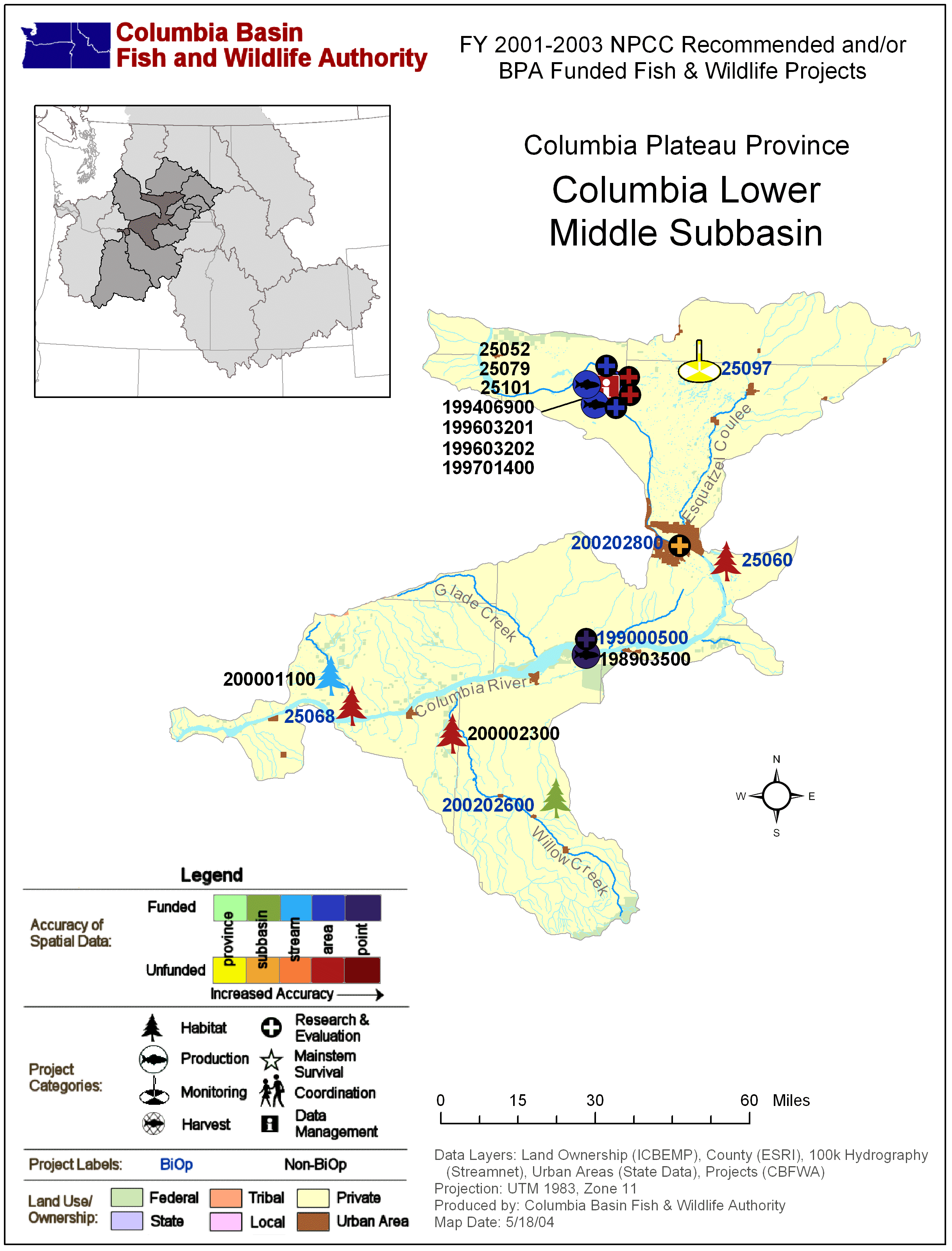
| Columbia Plateau: Columbia Lower Middle Subbasin Map with BPA Fish & Wildlife Projects | Subbasin Map |
| Columbia Plateau: Columbia Lower Middle Subbasin Map with BPA Fish & Wildlife Projects | Subbasin Map |
Section 1. Administrative
| Proposal title | Integration and Construction of a GIS Based 2-Dimensional Hydraulic/Habitat Model for 51 miles of Hanford Reach and Site of the Columbia River |
| Proposal ID | 25079 |
| Organization | U.S. Fish & Wildlife Service - Columbia River Fisheries Program Office (USFWS) |
| Proposal contact person or principal investigator | |
| Name | Donald R. Anglin |
| Mailing address | 9317 NE HWY 99, Suite I Vancouver, WA 98665 |
| Phone / email | 3606967605 / don_anglin@fws.gov |
| Manager authorizing this project | Donald R. Anglin |
| Review cycle | Columbia Plateau |
| Province / Subbasin | Columbia Plateau / Mainstem Columbia |
| Short description | Integration and Construction of a GIS Database and 2-Dimensional Hydraulic/Habitat Model for 51 miles of the Hanford Reach and Hanford Site of the Columbia River |
| Target species | Anadromous |
Project location
| Latitude | Longitude | Description |
|---|---|---|
| 46.3077 | -119.25 | Columbia River at Richland, WA |
| 46.644 | -119.9099 | Columbia River at Priest Rapids Dam |
| 46.6708 | -119.4325 | Hanford Reach |
Reasonable and Prudent Alternatives (RPAs)
Sponsor-reported:
| RPA |
|---|
Relevant RPAs based on NMFS/BPA review:
| Reviewing agency | Action # | BiOp Agency | Description |
|---|
Section 2. Past accomplishments
| Year | Accomplishment |
|---|---|
| 2001 | Modeling work for Chum & Chinook salmon below Bonneville Dam enabled USFWS staff to provide salmon managers with detailed relations between dam operations and water depths of ESA listed stocks and recommend hydrosystem operations through emergence. |
| 2001 | Within the modeling framework USFWS staff installed gages in the Columbia River and real-time access of data was made available on the Fish Passage Centers web page enabling real-time research and management decision making capabilities. |
Section 3. Relationships to other projects
| Project ID | Title | Description |
|---|---|---|
| 199102900 | Life History and Survival of Fall Chinook Salmon in Columbia River Basin-Facilitate implementation of federal and tribal fall chinook salmon recovery plans by monitoring and evaluating post-release attributes and survival of natural and hatchery juvenile | USGS's model of 17 river miles will be integrated and expanded into the overall modeling effort for the entire Hanford Reach. USGS will provide technical assistance in model production and calibration. |
| 199701400 | Evaluation of Juvenile Fall Chinook Stranding on the Hanford Reach - Evaluate effect of diel water fluctuations resulting from power peaking activities at Priest Rapids Dam on: 1) rearing juvenile fall chinook, 2) resident fish, and 3) the benthic comm. | Our model integration will provide WDFW with a spatially exspicit and quantifiable model to enumerate standing of juvenile fall chinook, resident fishes and effects on benthic macroinvertebrates. |
| 199406900 | Develop Spawning Habitat Model to Aid Recovery Plans for Snake River Fall Chinook Salmon- Investigate ground-water/surface-water interactions influencing fall Chinook salmon spawning site selection in the Hanford Reach of the Columbia River. | Data integration and provide PNNL with spatially explicit and quantifiable model to enumerate spawning fall chinook in the Hanford reach. |
| 19990030 | Evaluate Spawning of Fall Chinook and Chum Salmon Just below the Four Lowermost Columbia River Mainstem Dams - Determine and quantify the relationalship between streamflow and habitat conditions in the tailraces of each Dam | Information and technology transfer. |
| 198605000 | White Sturgeon Mitigation And Restoration In The Columbia And Snake Rivers - Determine the Status and Habitat Requirements for White Sturgeon. | Data transfer, model integration and georeferencing of 122 cross sections in the Hanford reach and provide a with spatially explicit and quantifiable model to enumerate spawning fall chinook in the Hanford reach. |
Section 4. Budget for Planning and Design phase
Task-based budget
| Objective | Task | Duration in FYs | Estimated 2002 cost | Subcontractor |
|---|---|---|---|---|
| N/A | $0 |
Outyear objectives-based budget
| Objective | Starting FY | Ending FY | Estimated cost |
|---|---|---|---|
| N/A | $0 |
Outyear budgets for Planning and Design phase
Section 5. Budget for Construction and Implementation phase
Task-based budget
| Objective | Task | Duration in FYs | Estimated 2002 cost | Subcontractor |
|---|---|---|---|---|
| Objective 1. Identify and Compile georeferenced data sets of the Hanford Reach of the Columbia River | Task 1.a. Identify and contact administrators of relevant data sets and provide for acquisition of data. | 0.5 | $33,286 | |
| 1 | Task 1.b. Review data sets for integration, transform data as necessary and integrate into ArcInfo data base and identify gaps in the data. | 0.2 | $20,000 | |
| Objective 2. Collect Georeferenced Bathymetry and Topography data for areas with gaps and/or insufficient resolution | Task 2.a. Conduct georeferenced suveys collecting bathymetry and topography data with either a SHOALS survey and/or hydoacoustic survey equipment and modern surverying equipment. | 1.0 | $125,000 | Yes |
| 2 | Task 2.b. Georeference USFWS (Project 198605000) cross sections for integration of 122 cross sections and the hydraulics associated with them for model integration and calibration | 0.25 | $25,000 | |
| 2 | Task 2.c. Conduct Substrate surveys as required using hydroacoustic and underwater video equipment | 0.25 | $25,000 | |
| 2 | Task 2.d. Final collation and integration of field data into GIS data base. | 0.2 | $4,500 | |
| Objective 3. Model Generation, Calibration, Maintenance and Distribution | Task 3.a. Generate a finite element mesh for the entire Hanford reach encompassing all areas to be inundated at Priest Rapids discharges up to 500,000 cubic feet second. Model river metrics at 10 kcfs increments and perform model calibration. | 0.25 | $15,000 | |
| 3 | Task 3.b. Construct GIS coverages of habitat variables important to spawning and rearing adadromous fishes such as velocity, gradient, depth, and substrate. | 2.0 | $30,000 | |
| 3 | Task 3.c Generate Metadata, maintain and construct database for distribution. | 0.25 | $10,000 | |
| 3 | Task 3.d. Provide data to salmon managers via CD-ROM data base and/or enable access of model through a web server. | 1.0 | $8,000 |
Outyear objectives-based budget
| Objective | Starting FY | Ending FY | Estimated cost |
|---|---|---|---|
| Objective 3. Model Generation, Calibration, Maintenance and Distributioin | 2003 | 2006 | $165,000 |
Outyear budgets for Construction and Implementation phase
| FY 2003 | FY 2004 | FY 2005 | FY 2006 |
|---|---|---|---|
| $150,000 | $5,000 | $5,000 | $5,000 |
Section 6. Budget for Operations and Maintenance phase
Task-based budget
| Objective | Task | Duration in FYs | Estimated 2002 cost | Subcontractor |
|---|---|---|---|---|
| N/A | $0 |
Outyear objectives-based budget
| Objective | Starting FY | Ending FY | Estimated cost |
|---|---|---|---|
| N/A | $0 |
Outyear budgets for Operations and Maintenance phase
Section 7. Budget for Monitoring and Evaluation phase
Task-based budget
| Objective | Task | Duration in FYs | Estimated 2002 cost | Subcontractor |
|---|---|---|---|---|
| Objective 4. Model maintenance, upgrade and calibration as new data sets and information become available in out years | Task 1.a. Udate model elements to encorporate new data for sections of the reach encompassing all areas to be inundated at Priest Rapids discharges of 500,000 cubic feet second. | .25 | $0 | |
| 1 | Task 1b. Update GIS coverages of habitat variables important to spawning and rearing adadromous fishes such as velocity, gradient, depth, and substrate. | 1 | $0 | |
| 1 | Task 1.c Update Metadata, and maintain database for distribution. | .25 | $0 | |
| 1 | Task 1.d. Provide data to salmon managers via CD-ROM data base and/or enable access of model through a web server. | 1 | $0 |
Outyear objectives-based budget
| Objective | Starting FY | Ending FY | Estimated cost |
|---|---|---|---|
| Objective 1. Model maintenance, upgrade and calibration as new data sets and information become available in out years | 2003 | 2006 | $200,000 |
Outyear budgets for Monitoring and Evaluation phase
| FY 2003 | FY 2004 | FY 2005 | FY 2006 |
|---|---|---|---|
| $50,000 | $50,000 | $50,000 | $50,000 |
Section 8. Estimated budget summary
Itemized budget
| Item | Note | FY 2002 cost |
|---|---|---|
| Personnel | FTE: 2.13 | $81,591 |
| Fringe | $22,845 | |
| Supplies | $3,778 | |
| Travel | $10,000 | |
| Indirect | Administrative Overhead | $37,572 |
| Subcontractor | U.S. Army COE - SHOALS Survey | $125,000 |
| Other | Vehicle leasing and boat operation and maintenance | $15,000 |
| $295,786 | ||
Total estimated budget
| Total FY 2002 cost | $295,786 |
| Amount anticipated from previously committed BPA funds | $0 |
| Total FY 2002 budget request | $295,786 |
| FY 2002 forecast from 2001 | $0 |
| % change from forecast | 0.0% |
Cost sharing
| Organization | Item or service provided | Amount | Cash or in-kind |
|---|
Reviews and recommendations
This information was not provided on the original proposals, but was generated during the review process.
Fundable only if response is adequate
Jun 15, 2001
Comment:
Do not fund unless adequate responses are given to ISRP concerns. Despite the concerns, the reviewers note that this is a solid proposal and is clearly related to Hanford Reach concerns. The GIS, database, and bathymetry data collection portions of this look good, and the proposal delivered a well-written comprehensive overview. However, the ISRP has significant concerns about the applicability of this proposal.
- The response should justify applicability of the project to the Columbia River Fish and Wildlife Program, beyond a list. This proposal does not appear to be a high priority. Will the other researchers involved in the Hanford Reach studies use this?
- The proposal contains good language about cooperation, and cooperation with USGS seems guaranteed by the inclusion of co-PIs. Could PNNL be a co-PI?
- The modeling piece raises questions about whether this model will be flexible and accessible enough to incorporate results of expectable future research that may refine or redefine the habitat variables that constitute spawning habitat. This proposal offers a two dimensional model. A three-dimensional model would be much more useful. Has a model steering committee with representatives from the other groups, such as PNNL that are also working on spawning habitat characterization, been considered. The fall chinook stranding group (#199701400) may have PNNL doing some modeling work to predict the areas that might be dewatered under various flow regimes. The PI's should look into this.
Generally, the success of this project is very dependent on cooperation and buy-in: for obtaining data, for the project to provide access to the product, and for the relevant user community to in fact use the product. More detail and statements of commitment on all three parts of the cooperation/buy-in issue are needed.
Comment:
Comment:
Fundable technically and this could provide a valuable product, but as noted in the preliminary review, the prospects for success is vulnerable to many "people issues" that are difficult to predict with the information provided.The response indicated that a working group would "meet periodically" and may be a formal or informal group. Access to the product is clearly described. Use of the product by the relevant community is not adequately addressed. The response notes that information from a similar tool for a river segment downstream from Bonneville Dam has been "regularly accessed and used".
More specific information is needed about the obligations and commitments of the working group. The amount of use to be expected by the relevant community should be estimated based on quantified use for similar products elsewhere.
See detailed ISRP comments on Hanford Reach projects
Comment:
Statement of Potential Biological Benefit to ESUN/A (for RPA ESUs)
Comments
The SHOALs data collection components should be funded somewhere.
Already ESA Req? NA
Biop? no
Comment:
The intent of this proposal is to make a 2-Dimensional model of the Hanford Reach. It is essentially a duplication of many existing aquatic habitat models currently available through the efforts of Battelle, the Pacific Northwest National Laboratory and the USGS-BRD. While the proposal sponsor claims that this model will enable quantification of juvenile fall chinook stranding, two-dimensional models such as the one described by this proposal do not enable quantification of fish impacts. If this were possible, Grant PUD and the WDFW would not have expended thousands of hours of field sampling over the past 5 years on this issue. The sponsor also claims that the model would allow enumeration of fall chinook spawning. Again, if this were true, aerial redd counts conducted by PNNL, and fall chinook redd counts and monitoring conducted by Grant PUD under the Vernita Bar Agreement, would not be necessary.Comment:
Comment:
Comment: