FY 2001 Innovative proposal 200101100
Contents
Section 1. General administrative information
Section 2. Past accomplishments
Section 3. Relationships to other projects
Section 4. Budgets for planning/design phase
Section 5. Budgets for construction/implementation phase
Section 6. Budgets for operations/maintenance phase
Section 7. Budgets for monitoring/evaluation phase
Section 8. Budget summary
Reviews and Recommendations
Additional documents
| Title | Type |
|---|---|
| 22050 Narrative | Narrative |
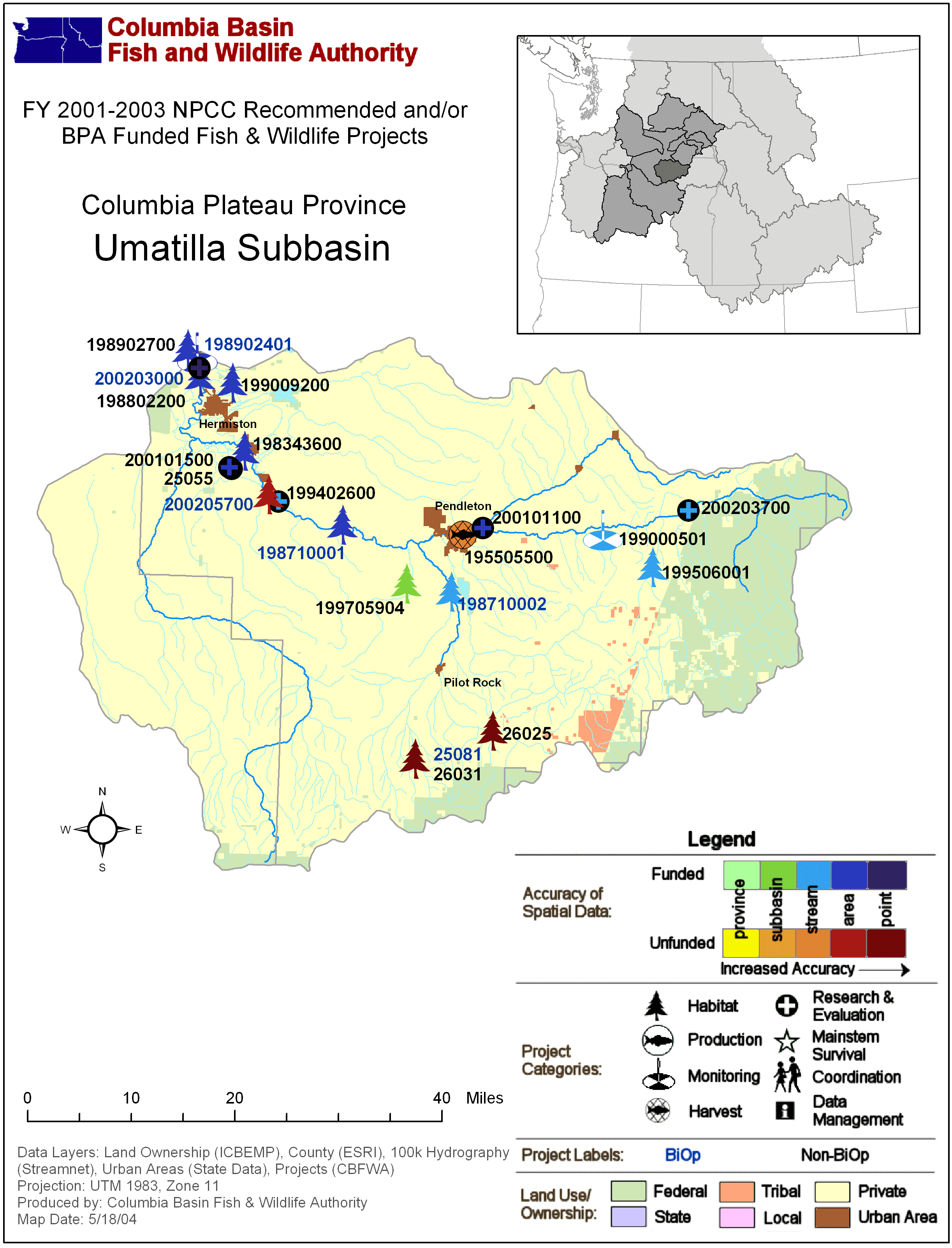
| Columbia Plateau: Umatilla Subbasin Map with BPA Fish & Wildlife Projects | Subbasin Map |
| Columbia Plateau: Umatilla Subbasin Map with BPA Fish & Wildlife Projects | Subbasin Map |
| 22050 Narrative | Narrative |
| Original Project Proposal for project 22050 | Narrative Attachment |
Section 1. Administrative
| Proposal title | Habitat Diversity in Alluvial Rivers |
| Proposal ID | 200101100 |
| Organization | Confederated Tribes of the Umatilla Indian Reservation (CTUIR) |
| Proposal contact person or principal investigator | |
| Name | Scott O'Daniel |
| Mailing address | 73239 Confederated Way Pendleton, OR. 97801 |
| Phone / email | 5419662594 / scottodaniel@ctuir.com |
| Manager authorizing this project | Rick George |
| Review cycle | FY 2001 Innovative |
| Province / Subbasin | Columbia Plateau / Umatilla |
| Short description | Developing innovative remote sensing and modeling tools for quantitative functional assessment of aquatic habitats by integrating spatialtemporal interactions between channels, floodplain and groundwater. |
| Target species | All aquatic organisms, including resident and anadramous fish. |
Project location
| Latitude | Longitude | Description |
|---|---|---|
| 45.85 | -119.32 | Umatilla River, near mouth |
| 45.68 | -118.75 | Umatilla River |
| 45.69 | -118.45 | Umatilla River |
Reasonable and Prudent Alternatives (RPAs)
Sponsor-reported:
| RPA |
|---|
Relevant RPAs based on NMFS/BPA review:
| Reviewing agency | Action # | BiOp Agency | Description |
|---|
Section 2. Past accomplishments
| Year | Accomplishment |
|---|
Section 3. Relationships to other projects
| Project ID | Title | Description |
|---|
Section 4. Budget for Planning and Design phase
Task-based budget
| Objective | Task | Duration in FYs | Estimated 2001 cost | Subcontractor |
|---|
Outyear objectives-based budget
| Objective | Starting FY | Ending FY | Estimated cost |
|---|
Outyear budgets for Planning and Design phase
Section 5. Budget for Construction and Implementation phase
Task-based budget
| Objective | Task | Duration in FYs | Estimated 2001 cost | Subcontractor |
|---|
Outyear objectives-based budget
| Objective | Starting FY | Ending FY | Estimated cost |
|---|
Outyear budgets for Construction and Implementation phase
Section 6. Budget for Operations and Maintenance phase
Task-based budget
| Objective | Task | Duration in FYs | Estimated 2001 cost | Subcontractor |
|---|
Outyear objectives-based budget
| Objective | Starting FY | Ending FY | Estimated cost |
|---|
Outyear budgets for Operations and Maintenance phase
Section 7. Budget for Monitoring and Evaluation phase
Task-based budget
| Objective | Task | Duration in FYs | Estimated 2001 cost | Subcontractor |
|---|
Outyear objectives-based budget
| Objective | Starting FY | Ending FY | Estimated cost |
|---|
Outyear budgets for Monitoring and Evaluation phase
Section 8. Estimated budget summary
Itemized budget
| Item | Note | FY 2001 cost |
|---|---|---|
| Personnel | $62,025 | |
| Fringe | $15,967 | |
| Supplies | $33,400 | |
| Travel | $5,500 | |
| Indirect | $36,758 | |
| Subcontractor | # of tags: Leal Mertes, Associate Prof. University of California at Santa Barbara Geoffrey Poole, Ecometrics | $166,210 |
| $319,860 | ||
Total estimated budget
| Total FY 2001 cost | $319,860 |
| Total FY 2001 budget request | $319,860 |
Cost sharing
| Organization | Item or service provided | Amount | Cash or in-kind |
|---|---|---|---|
| CTUIR | GIS lab equiptment and system administration | $15,700 | in-kind |
| Bureau of Reclamation | LIDAR flight | $218,312 | in-kind |
| EPA | Hydrogeomorphic (HGM) Classification | $50,755 | cash |
Reviews and recommendations
This information was not provided on the original proposals, but was generated during the review process.
Comment:
This is judged as the best of the three innovative proposals that proposed to make use of LIDAR (airborne laser altimetry) data to obtain detailed habitat and physical information about streamside vegetation, channel cross-sections, and channel slopes. The vertical resolution has accuracy to tens of centimeters and can measure the height of vegetation with accuracy of horizontal resolutions in meters. See proposals 22049 and 22059. This proposal has a good interface of various fields of endeavor. It is well written, and clearly articulates how this detailed source of topographic and vegetation data would be used to assess connections between catchment hydrology, channel geomorphology, and ecological function. The proposal draws on past work in the Umatilla basin, and would be a collaboration of tribal, university, and state agency personnel. In addition to use of LIDAR data, stream temperature assessment and modeling would be facilitated through use of airborne infrared surveys, and the project would draw on other sources of remote sensing data (e.g., SRTM – Shuttle Radar Topography Mapping mission) available through one of the Co-Principal Investigator's NASA projects. The proposal is innovative in seeking to apply evolving remote sensing tools to habitat restoration projects within the basin. The panel was particularly impressed by the collaborative nature of the work, which should help assure that the work aids in transferring knowledge about data sources that should be of value in future projects.Comment:
The proposal could be improved if more of a terrestrial scope is incorporated. The proposal should be modified to include a phase that focuses on the terrestrial species and processes.Comment:
The proposal could be improved if more of a terrestrial scope is incorporated. The proposal should be modified to include a phase that focuses on the terrestrial species and processes.Comment:
Comment:
Project will be complete in FY04, innovative from 2001.Comment: