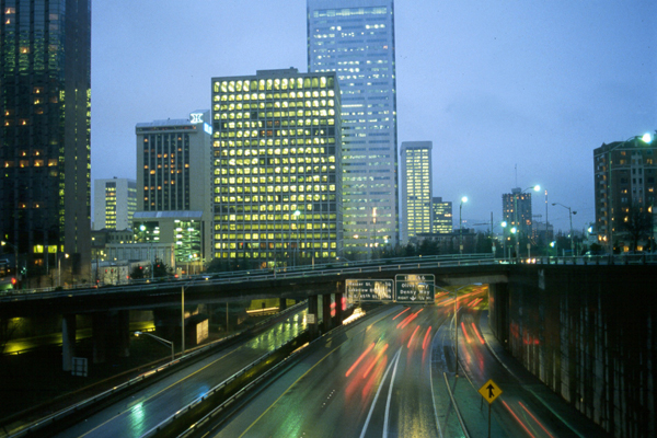
No. 20. Urban and Mixed EnvironsHoward L. FergusonGeographic Distribution. Urban habitat occurs throughout Oregon and Washington. Most urban development is located west of the Cascades of both Oregon and Washington, with the exception of Spokane, Washington, which developed because of early railroad systems and connections to the East. However, urban growth is being felt in almost every small town throughout the Pacific Northwest. Physical Setting. Urban development occurs in a variety of sites in the Pacific Northwest. It creates a physical setting unique to itself: temperatures are elevated and background lighting is increased; wind velocities are altered by the urban landscape, often reduced except around the tallest structures downtown, where high-velocity winds are funneled around the skyscrapers. Urban development often occurs in areas with little or no slope and frequently includes wetland habitats. Many of these wetlands have been filled in and eliminated. Today, ironically, many artificial "wetland" impoundments are being created for stormwater management, whose function is the same as the original wetland that was destroyed. Landscape Setting. Urban development occurs within or adjacent to nearly every habitat type in Oregon and Washington, and often replaces habitats that are valuable for wildlife. The highest urban densities normally occur in lower elevations along natural or human-made transportation corridors, such as rivers, railroad lines, coastlines, or interstate highways. These areas often contain good soils with little or no slope and lush vegetation. Once level areas become crowded, growth continues along rivers or shores of lakes or oceans, and eventually up elevated sites with steep slopes or rocky outcrops. Because early settlers often modified the original landscape for agricultural purposes, many of our urban areas are surrounded by agricultural and grazing lands. Structure. The original habitat is drastically altered in urban environments and is replaced by buildings, impermeable surfaces, bridges, dams, and planting of non-native species. Some human-made structures provide habitats similar to those of cavities, caves, fissures, cliffs, and ledges. With the onset of urban development, total crown cover and tree density are reduced to make way for the construction of buildings and associated infrastructure. Many structural features typical of the historical vegetation, such as snags, dead and downed wood, and brush piles, are often completely removed from the landscape. Understory vegetation may be completely absent, or if present, is diminutive and single-layered. Typically, 3 zones are characteristic of urban habitat. High-density Zone
In the high-density zone, land-use practices have removed most of the native vegetation. Patch sizes of remaining natural areas often are so small that native interior species cannot be supported. Not only are remaining patches of native vegetation typically disconnected, but also they are frequently missing the full complement of vertical strata 149. Stream corridors become heavily impacted and discontinuous. Most, if not all, wetlands have been filled or removed. Large buildings dominate the landscape and determine the placement of vegetation in this zone 30a. This zone has the most street tree strips or sidewalk trees, most of which are exotics. There is virtually no natural tree replacement, and new trees are planted only when old ones die or are removed. Replacement trees are chosen for their small root systems and are generally short in stature with small diameters. Ground cover in this zone, if not synthetic or impervious, is typically exotic grasses or exotic annuals, most of which are rarely allowed to go to seed. Snags, woody debris, rock piles, and any other natural structures are essentially nonexistent. There are few tree cavities because of cosmetic pruning, cavity filling, snag removal, and tree thinning 149. Medium-density Zone
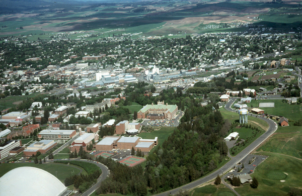
Vegetation in this mid-zone is typically composed of non-native plant species. Native plants, when present, represent only a limited range of the natural diversity for the area. The shrub layer is typically clipped or minimal, even in heavily vegetated areas. Characteristic of this zone are manicured lawns, trimmed hedges, and topped trees. Lawns can be highly productive 82a,97a. Tree canopy is still discontinuous and consists of 1-2 levels, if present at all. Consequently, vertical vegetative diversity and total amount of understory are still low. Coarse and fine woody debris is minimal or absent; most snags and diseased live trees are still removed as hazards in this zone 119a, 119b. Isolated wetlands, stream corridors, open spaces, and greenbelts are more frequently retained in this zone than in the high-density zone. However, remnant wetland and upland areas are often widely separated by urban development. Low-density Zone
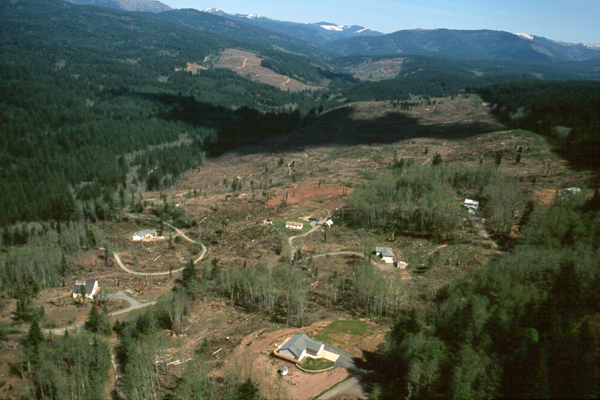
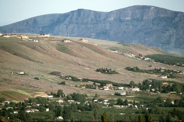
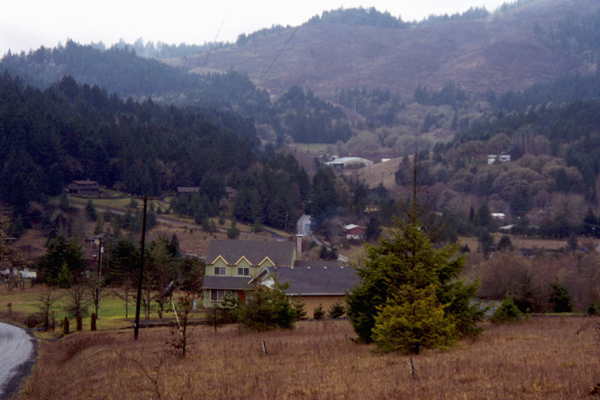
Roads, fences, livestock paddocks, and pets are more abundant than in neighboring rural areas. With many animals and limited acreage, pasture conditions may be more overgrazed in this zone than in the rural zone; overgrazing can significantly affect shrub layers as well. Areas around home sites are often cleared for fire protection. Dogs are more likely to be loose and allowed to run free, increasing disturbance levels and wildlife harassment in this zone. Vegetable and flower gardens are widespread; fencing is prevalent.Many wetlands remain and are less impacted. Water levels are more stable and peak flows are more typical of historical flows. Watertables are less impacted and vernal wetlands are more frequent; stream corridors are less impacted and more continuous. Although this zone may have large areas of native vegetation and is generally the least impacted of all 3 zones; it still has been significantly altered by human activities and associated disturbances.
Composition. Remnant isolated blocks of native vegetation may be found scattered throughout a town or city mixed with a multitude of introduced exotic vegetation. As urban development increases, these remnant native stands become fragmented and isolated. The dominant species in an urban setting may be exotic or native; for example, in Seattle, the dominant species in 1 area may be Douglas-fir (Pseudotsuga menziesii), whereas a few blocks away it may be the exotic silver maple (Acer saccharinum). Dominant species will not only vary from city to city but also within each city and within each of the 3 urban zones. Nowack 167 found that in the high-density urban zone, species richness is low, and in 1 case, 4 species made up almost 50% of the cover. In the same study, exotics made up 69% of the total species.
Interest in the use of native plants for landscaping is rapidly expanding 135, 172, particularly in the more arid sites where drought-resistant natives are the only plants able to survive without water. Across the U.S., urban tree cover ranges from 1 to 55% 167. As expected, tree cover tends to be highest in cities developed in naturally forested areas with an average of 32% cover in forested areas, 28% in grasslands, and 10% in arid areas. Yakima, Washington, has an overall city tree cover of 18%, ranging from 10% to 12% in the industrial/commercial area to 23% in the low-density residential zone 167. Remnant blocks of native vegetation or native trees left standing in yards and parks will compositionally be related to whatever native habitat was present on site prior to development. In the Puget Sound and Willamette Valley areas, Douglas-fir is a major constituent, whereas the Spokane area has a lot of ponderosa pine (Pinus ponderosa). Other Classifications and Key References. Many attempts have been made to classify or describe the complex urban environment. The Washington GAP Analysis 37 classified urban environments as "developed" land cover using the same 3 zones as described above: (1) high density (>60% impervious surface); (2) medium density (30-60% impervious surface); and (3) low density (10-30% impervious surface). The Oregon Gap II Project 126 and Oregon Vegetation Landscape-Level Cover Types 127 represented this type as an urban class. Several other relevant strudies characterizing the urban environment have been reported 182, 129, 34, 70, 151. Natural Disturbance Regime. In many instances, natural disturbances are modified or prevented from occurring by humans over the landscape and this is particularly true of urban areas. However, disturbances such as ice, wind, or firestorms still occur. The severity of these intermittent disturbances varies greatly in magnitude and their impact on the landscape varies accordingly. One of the differences between urban and nonurban landscapes is the lengthening of the disturbance cycles. Another is found in the aftermath of these disturbances. In urban areas, damaged trees are often entirely removed and if they are replaced, a shorter, smaller tree, often non-native, is selected. The natural fire disturbance interval is highly modified in the urban environment. Fire (mostly accidental or arson) still occurs, and is quickly suppressed. Another natural disturbance in many of our Pacific Northwest towns is flooding, which historically altered and rerouted many of our rivers and streams, and still scarifies fields and deposits soil on flood plains and potentially recharges local aquifers. Floods now are more frequent and more violent than in the past because of the many modifications made to our watersheds. Attempts to lessen flooding in urban areas often lead to channelization, paving, or diking of our waterways, most of which fail in their attempt to stem the flooding and usually result in increased flooding for the communities farther downstream. Succession and Stand Dynamics. Due to anthropogenic influences found in the urban environment, succession differs in the urban area from that expected for a native stand. Rowntree 185 emphasized that urbanization is not in the same category as natural disturbance in affecting succession. He points out that urbanization is anthropogenic and acts to remove complete vegetation associations and creates new ones made of mixes of native residual vegetation and introduced vegetation. Much human effort in the city goes toward either completely removing native vegetation or sustaining or maintaining a specific vegetative type, e.g., lawns or hedges. Much of the vegetative community remains static. Understory and ground covers are constantly pruned or removed, seedlings are pulled and lawns are planted, fertilized, mowed, and meticulously maintained. Trees may be protected to maturity or even senescence, yet communities are so fragmented or modified that a genuine old-growth community never exists. However, a type of "urban succession" occurs across the urban landscape. The older neighborhoods with their mature stands are at a later seral stage than new developments; species diversity is characteristically higher in older neighborhoods as well. An oddity of the urban environment is the absence of typical structure generally found within the various seral stages. For example, the understory is often removed in a typical mid-seral stand to give it a "park-like" look. Or if the understory is allowed to remain, it is kept pruned to a consistent height. Lawns are the ever-present substitute for native ground covers. Multi-layered habitat is often reduced to 1 or 2 heights. Vertical and horizontal structural diversity is drastically reduced. Effects of Management and Anthropogenic Impacts. These additional, often irreversible, impacts include more impervious surfaces, more and larger human-made structures, large-scale storm and wastewater management, large-scale sewage treatment, water and air pollution, toxic chemicals, toxic chemical use on urban lawns and gardens, removal of species considered to be pests, predation and disturbance by pets and feral cats and dogs, and the extensive and continual removal of habitat due to expanding urbanization, and in some cases, uncontrolled development. Another significant impact is the introduction and cultivation of exotics in urban areas. Native vegetation is often completely replaced by exotics, leaving little trace of the native vegetative cover. Status and Trends. From 1970 to 1990, >30,000 mile2 (77,700 km2) of rural lands in the U.S. became urban, as classified by the U.S. Census Bureau. That amount of land equals about one third of Oregon’s total land area 12. From 1940 to 1970, the population of the Portland urban region doubled and the amount of land occupied by that population quadrupled 201. More than 300 new residents arrive in Washington each day, and each day, Washington loses 100 acres (41 ha) of forest to development 215. Using satellite photos and GIS software, American Forests 9 discovered that nearly one third of Puget Sound’s most heavily timbered land has disappeared since the early 1970's. The amount of land with few or no trees more than doubled, from 25% to 57%, an increase of >1 million acres (404,858 ha). Development and associated urban growth was blamed as the single biggest factor affecting the area’s environment. This urban growth is predicted to continue to increase at an accelerated pace, at the expense of native habitat. [ Top ] [ Literature Citations ] [ Wildlife-Habitat Types - Table 1 ] |