No. 21. Open Water - Lakes, Rivers, and StreamsEva L. Greda, David H. Johnson, and Tom O’NeilLakes, Ponds, and Reservoirs Geographical Distribution. Lakes in Oregon and Washington occur statewide and are found from near sea level to about 10,200 ft (3,110 m) above sea level. There are 3,887 lakes and reservoirs in western Washington and they total 176,920 acres (71,628 ha) 226. In contrast, there are 4,073 lakes and reservoirs in eastern Washington that total 436,843 acres (176,860 ha) 227. There are 6,000 lakes, ponds, and reservoirs in Oregon including almost 1,800 named lakes and over 3,800 named reservoirs, all amounting to 270,641 acres (109,571 ha). Oregon has the deepest lake in the nation, Crater Lake, at 1,932 ft (589 m) 23.
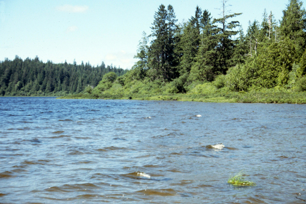
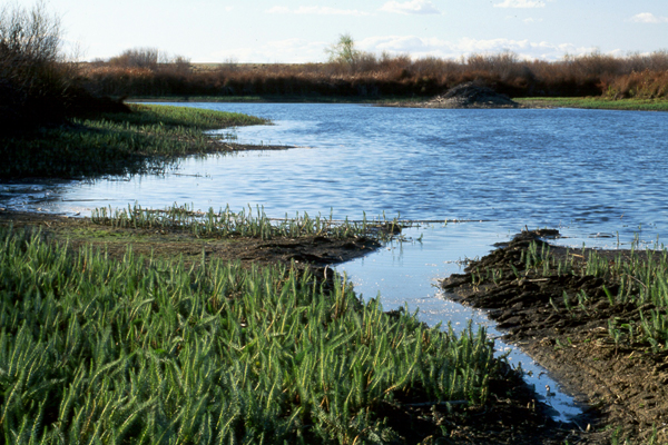
Structure. There are 4 distinct zones within this aquatic system: (1) the littoral zone at the edge of lakes is the most productive with diverse aquatic beds and emergent wetlands (part of Herbaceous Wetland's habitat); (2) the limnetic zone is deep open water, dominated by phytoplankton and freshwater fish, and extends down to the limits of light penetration; (3) the profundal zone below the limnetic zone, devoid of plant life and dominated with detritivores; (4) and the benthic zone reflecting bottom soil and sediments. Nutrients from the profundal zone are recycled back to upper layers by the spring and fall turnover of the water. Water in temperate climates stratifies because of the changes in water density. The uppermost layer, the epilimnion, is where water is warmer (less dense). Next, the metalimnion or thermocline, is a narrow layer that prevents the mixing of the upper and lowermost layers. The lowest layer is the hypolimnion, with colder and most dense waters. During the fall turnover, the cooled upper layers are mixed with other layers through wind action.
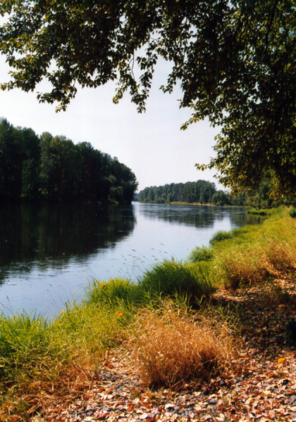
Floods occur in Oregon and Washington every year. Flooding season west of the Cascades occurs from October through April, with more than half of the floods occurring during December and January. Floods are the result of precipitation and snow melts. Floods west of the Cascades are influenced by precipitation mostly and thus are short-lived, while east of the Cascades floods are caused by melting snow, and the amount of flooding depends on how fast the snow melts. High water levels frequently last up to 60 days. In 1984, heavy precipitation flooded Malheur and Harney lakes to the point where the 2 lakes were joined together for several years. The worst floods have resulted from cloudbursts caused by thunderstorms, like Heppner, Oregon’s 1903 flood. Other "flash floods" in the region were among the largest floods in the U.S. and occurred in the John Day Basin’s Meyers Canyon in 1956 and the Umatilla Basin’s Lane Canyon in 1965 23. Effects of Management and Anthropogenic Impacts. Sewage effluents caused eutrophication of Lake Washington in Seattle, where plants increased in biomass and caused decreased light transmission. The situation was corrected, however, before it became serious as a result of a campaign of public education, and timely cleanup of the lake 146. Irrigation projects aimed at watering drier portions of the landscape may pose flooding dangers, as was the case with Soap Lake and Lake Leonore in eastern Washington. Finally, natural salinity of lakes can decrease as a result of irrigation withdrawal and can change the biota associated with them 92. Rivers and Streams Geographic Distribution. Streams and rivers are distributed statewide in Oregon and Washington, forming a continuous network connecting high mountain areas to lowlands and the Pacific coast. There are >12,000 named rivers and streams in Oregon, totalling 112,640 miles (181,238 km) 23 in length. Oregon’s longest stretch of river is the Columbia (309 miles [497 km]) that borders Oregon and Washington. The longest river in Oregon is the John Day (284 miles [457 km]) and the shortest river is the D River (440 ft [134 m]) that is the world’s second shortest river. Washington has more streams than any other state except Alaska. In Washington, the coastal region has 3,783 rivers and streams totaling 8,176 miles (13,155 km) 174. The Puget Sound Region has 10,217 rivers and streams, which add to 16,600 miles (26,709 km) in length 223. The rivers and streams range from cold, fast-moving high-elevation streams to warmer lowland valley rivers 223. In all, there are 13,955 rivers and streams that add up to 24,774 miles (39,861 km) 174. There are many more streams in Washington yet to be catalogued 174.
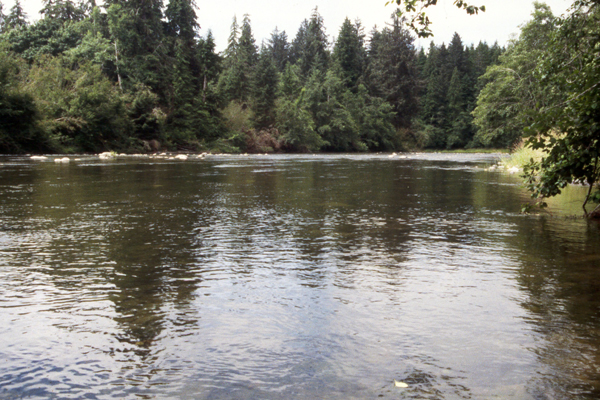
Rivers and streams in southwestern Oregon are fed by rain and are located in an area composed of sheared bedrock and is thus an unstable terrain. Streams in that area have high suspended-sediment loads. Beds composed of gravel and sand are easily transported during floods. The western Cascades in Washington and Oregon are composed of volcanically derived rocks and are more stable. They have low sediment-transport rates and stable beds composed largely of cobbles and boulders, which move only during extreme events 81. Velocities of river flow ranges from as little as 0.2 to 12 mph (0.3 to19.3 km/hr) while large streams have an average annual flow of 10 cubic feet (0.3 m3) per second or greater 23, 169. Rivers and streams in the Willamette Valley are warm, productive, turbid, and have high ionic strength. They are characterized by deep pools, and highly embedded stream bottoms with claypan and muddy substrates, and the greatest fish species diversity. High desert streams of the interior are similar to those of the Willamette Valley but are shallower, with fewer pools, and more runs, glides, cobbles, boulders, and sand. The Cascades and Blue mountains are similar in that they have more runs and glides and fewer pools, similar fish assemblages, and similar water quality 218.
Other Classifications and Key References. This habitat is called riverine and lacustrine in Anderson et al. 10, Cowardin et al. 53, Washington Gap Analysis Project 37, Mayer and Laudenslayer 150, and Wetzel 217. However, this habitat is referred to as Open Water in the Oregon Gap II Project 126 and Oregon Vegetation Landscape-Level Cover Types 127. Effects of Management and Anthropogenic Impacts. Removal of gravel results in reduction of spawning areas for anadromous fish. Overgrazing, and loss of vegetation caused by logging produces increased water temperatures and excessive siltation, harming the invertebrate communities such as that reported in the John Day River Basin, Oregon 146. Incorrectly installed culverts may act as barriers to migrating fish and may contribute to erosion and siltation downstream 174. Construction of dams is associated with changes in water quality, fish passage, competition between species, loss of spawning areas because of flooding, and declines in native fish populations 146. Historically, the region’s rivers contained more braided multi-channels. Flood control measures such as channel straightening, diking, or removal of streambed material along with urban and agriculture development have all contributed to a loss of oxbows, river meanders, and flood plains. Unauthorized or over-appropriated withdrawals of water from the natural drainages also has caused a loss of open water habitat that has been detrimental to fish and wildlife production, particularly in the summer 174. Agricultural, industrial, and sewage runoff such as salts, sediments, fertilizers, pesticides, and bacteria harm aquatic species 146. Sludge and heavy waste buildup in estuaries is harmful to fish and shellfish. Unregulated aerial spraying of pesticides over agricultural areas also poses a threat to aquatic and terrestrial life 174. Direct loss of habitat and water quality occurs through irrigation 130. The Oregon Department of Environmental Quality, after a study of water quality of the Willamette River, determined that up to 80% of water pollution enters the river from nonpoint sources and especially agricultural activity 23. Very large floods (e.g., Oregon Flood of 1964) may change the channels permanently through the settling of large amounts of sediments from hillslopes, through debris flow, and through movement of large boulders, particularly in the montane areas. The width of the channel along the main middle fork of the Willamette increased over a period of 8 years. Clearcutting creates excessive intermittent runoff conditions and increases erosion and siltation of streams as well as diminishes shade, and therefore causes higher water temperatures, fewer terrestrial and aquatic food organisms, and increased predation. Landslides, which contributed to the widening of the channel, were a direct result of clearcutting. Clearcut logging can alter snow accumulation and increase the size of peak flows during times of snowmelt 197. Clearcutting and vegetation removal affects the temperatures of streams, increasing them in the summer and decreasing in winter, especially in eastern parts of the Oregon and Washington 24. Building of roads, especially those of poor quality, can be a major contributor to sedimentation in the streams 82.
[ Top ] [ Literature Citations ] [ Wildlife-Habitat Types - Table 1 ] |