No. 23. Westside Riparian-WetlandsChristopher B. Chappell and Jimmy KaganGeographic Distribution. This habitat is patchily distributed in the lowlands and low mountains throughout the area west of the Cascade Crest south into northwestern California and north into British Columbia. It also occurs less extensively at mid- to higher elevations in the Cascade and Olympic mountains, where it is limited to more specific environments.
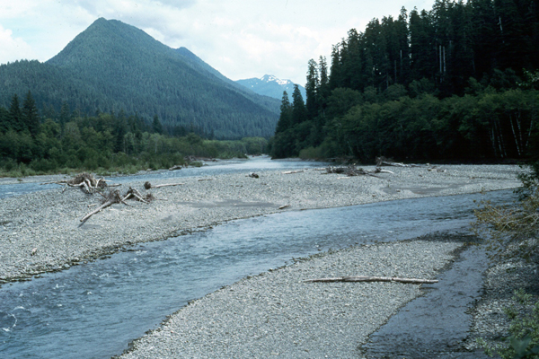
Landscape Setting. This habitat typically occupies patches or linear strips within a matrix of forest or regrowing forest. The most frequent matrix habitat is Westside Lowlands Conifer- Hardwood Forest. If not forest, the matrix can be Agriculture, Urban, or Coastal Dunes and Beaches habitats, or rarely Westside Grasslands or Ceanothus-Manzanita Shrublands. This habitat also forms mosaics with or includes small patches of Herbaceous Wetlands. Open Water habitat is often adjacent to Westside Riparian-Wetlands. The major land use of the forested portions of this habitat is timber harvest. Livestock grazing occurs in some areas. Peat mining occurs in some bogs.
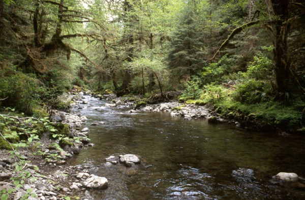
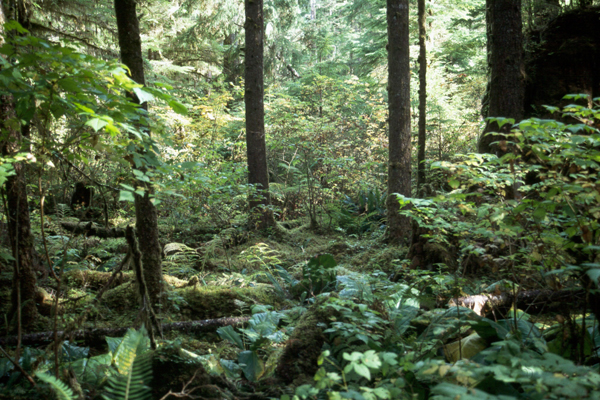
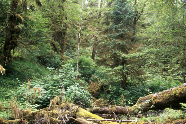
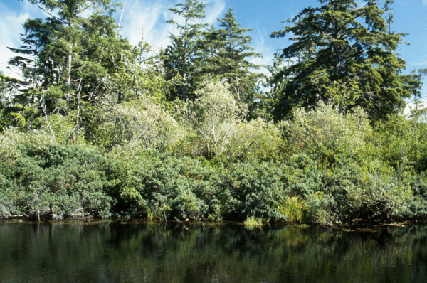
Composition. Red alder (Alnus rubra) is the most widespread tree species, but is absent from sphagnum bogs. Other deciduous broadleaf trees that commonly dominate or co-dominate include black cottonwood (Populus balsamifera ssp. trichocarpa), bigleaf maple (Acer macrophyllum), Oregon ash (Fraxinus latifolia), and, locally, white alder (Alnus rhombifolia). Pacific willow (Salix lucida ssp. lasiandra) can form woodlands on major floodplains or co-dominate with other willows in tall shrublands. Oregon white oak (Quercus garryana) and California black oak (Q. kelloggii) can be important in the interior valleys of western Oregon. Conifers that frequently dominate or co-dominate include western redcedar (Thuja plicata), western hemlock (Tsuga heterophylla), and Sitka spruce (Picea sitchensis). Grand fir (Abies grandis) sometimes co-dominates, especially in drier climates and riverine floodplains. Douglas-fir (Pseudotsuga menziesii) is relatively uncommon. Shore pine (Pinus contorta var. contorta) is common in bogs and in deflation plain wetlands along the outer coast. Dominant species in tall shrublands include Sitka willow (Salix sitchensis), Hooker’s willow (S. hookeriana), Douglas’ spirea (Spirea douglasii), red-osier dogwood (Cornus sericea), western crabapple (Malus fusca), salmonberry (Rubus spectabilis), stink currant (Ribes bracteosum), devil’s-club (Oplopanax horridum), and sweet gale (Myrica gale). Labrador-tea (Ledum groenlandicum, L. glandulosum), western swamp-laurel (Kalmia microphylla), sweet gale, and salal (Gaultheria shallon) often dominate sphagnum bogs. Vine maple (Acer circinatum) or Sitka alder (Alnus viridis ssp. sinuata) dominate tall shrublands in the mountains that are located on moist talus or in snow avalanche tracks. Forests and willow, spirea, and dogwood shrublands within this habitat are limited to the area west of the Cascade Crest. Oregon ash communities occur primarily in the southern Puget Lowland (King County south), Willamette Valley, and Klamath Mountains ecoregions. White alder occurs only in the Willamette Valley and southwestern Oregon. Sitka spruce communities are mainly found in the Coast Range ecoregion in areas of coastal fog influence. Western hemlock and western redcedar riparian and wetland habitats are largely absent from the southern Oregon Cascades and the Klamath Mountains. Sitka alder and vine maple communities are located in the mountains, mainly in western Washington but to a lesser degree on the east slope of the Cascades and in the Oregon Cascades. Sweet gale communities are found primarily at low elevations on the western Olympic Peninsula. Lodgepole pine- dominated communities are found as bogs in western Washington and along the outer coast of Oregon. Most sphagnum bogs are found in low elevation western Washington.
Other Classifications and Key References. This habitat includes all palustrine, forested wetlands and scrub-shrub wetlands at lower elevations on the westside as well as a small subset of persistent emergent wetlands, those within sphagnum bogs 53. However, drier portions of this habitat in riparian floodplains may not qualify as wetlands according to Cowardin’s definition 53. They are associated with both lentic and lotic systems. Much of this habitat is probably not mapped as distinct types by the Gap projects because of its relatively small scale on the landscape and the difficulty of distinguishing forested wetlands. A portion of this habitat is mapped as the Oregon Gap II Project 126 and Oregon Vegetation Landscape-Level Cover Types 127 westside cottonwood riparian gallery, palustrine forest, palustrine shrubland, NWI palustrine emergent, NWI (National Wetland Inventory) estuarine emergent, and alder/cottonwood riparian gallery. In the Washington Gap project, this habitat occupies portions of open water/wetlands (especially riparian), hardwood forest, and mixed hardwood/conifer forest, and to a minor degree, conifer forest in the following zones: Western hemlock, Sitka spruce, Olympic Douglas-fir, Puget Sound Douglas-fir, Cowlitz River, Willamette Valley, and Woodland/prairie mosaic. 37 This habitat also occupies much of hardwood forest in the Silver fir, Mountain hemlock, portions of Subalpine fir, Interior western hemlock/redcedar, and Grand fir zones. Other references describe this habitat 41, 71, 85, 88, 90, 91, 104, 113, 114, 115, 138, 210, 220.
Succession and Stand Dynamics. Riparian, i.e., streamside, habitats are extremely dynamic 162. Succession varies greatly depending on the hydro-geomorphic environment. A typical sequence on a riparian terrace on a large stream involves early dominance by Sitka willow, mid-seral dominance by red alder or cottonwood, with a gradual increase in conifers, and eventual late-seral dominance of spruce, redcedar, and/or hemlock. Such a sequence corresponds with increasing terrace height above the bankfull stream stage 85. Some communities in bogs or depressional wetlands, as opposed to riverine, seem to be relatively stable given a particular flooding regime and environment. Successional sequences are not completely understood and can be complex. Beaver dams or other alterations of flood regime often result in vegetation changes.
Status and Trends. This habitat occupies relatively small areas and has declined greatly in extent with conversion to urban development and agriculture. What remains is mostly in poor condition, having experienced any of various anthropogenic impacts that have degraded the functionality of these ecosystems: channeling, diking, dams, logging, road-building, invasion of exotic species, changes in hydrology and nutrients, and livestock grazing. Current threats include all of the above as well as development. Some protection has been afforded to this habitat through government regulations that vary in their scope and enforcement with jurisdiction. Of the 77 plant associations representing this habitat in the National Vegetation Classification, almost half are considered imperiled or critically imperiled 10. [ Top ] [ Literature Citations ] [ Wildlife-Habitat Types - Table 1 ] |