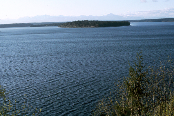
No. 29. Inland Marine Deeper WaterDavid H. JohnsonGeographic Distribution. This habitat is located in the northwestern portion of Washington and adjacent areas of southwest British Columbia. It includes the open waters of the Straight of Georgia, Puget Sound, Hood Canal, and the Straight of Juan de Fuca. More specifically, this habitat reflects waters >66 ft (20 m) deep, found inland from a line between the Elwha River (just west of Port Angeles) on the Washington side of the Strait of Juan de Fuca, northward to Race Rocks on the southeastern tip of Vancouver Island, British Columbia. This line was independently determined based on (1) kelp distribution, (2) marine bird distribution, and (3) fish species and abundance data. With the exception of Marine Nearshore areas, waters west of this line are considered Marine Shelf. The Inland Marine Deeper Waters habitat is not found in Oregon. Physical Setting. This habitat lies largely within the Puget Lowland and northward in Georgia Strait on the east side of Vancouver Island, British Columbia. Mean air temperatures generally range between 40 and 70°F (4-21°C) year round, with little north-south variation. Rainfall averages 20 to 80 inches (50 to 200 cm) annually and is concentrated in winter months, producing correspondingly high river runoff to bays, estuaries, and inland marine waters.
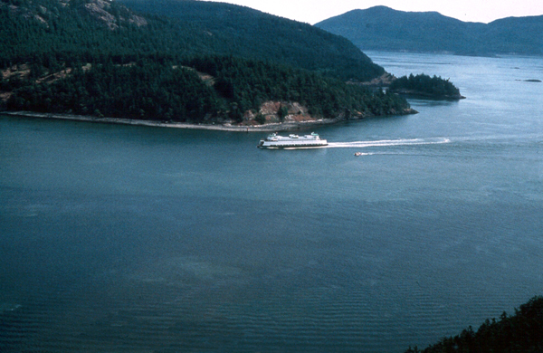
Structure. A diversity of underwater structures are created as swift tidal currents circulate waters of the Pacific Ocean through the reaches of Straight of Georgia, Puget Sound, Hood Canal and the Straight of Juan de Fuca. Aspects of geology are particularly important in understanding the structure and dynamics of this habitat. Glacial ice initially excavated several long, narrow valleys that today form Lake Washington, Lake Sammamish, Hood Canal, and the major basins of Puget Sound. The arrangement of the present shorelines was established 13,000 years ago when glacial ice retreated from the Puget Lowland 76. Organics, silt, and sand are the primary substrate components of this habitat and vary in specific composition and distribution with fluctuating physical factors 120. Through deposition of sediments, major river deltas have advanced substantial distances into the deep basins of Puget Sound 76. Composition. Marine waters dominate fresh water influences in areas away from riverine discharges or from the shoreline. Because of the water depths involved, sunlight is diffused, and few if any, plants attached to the benthic substrates are capable of growing. Other Classifications and Key References. Cowardin et al. 53 included this region in the Columbia Province and described a hierarchical classification for wetlands and deepwater habitats in the U.S. Dethier 68 described a classification for marine and estuarine habitat types in Washington State. Habitat types were defined by depth, substratum type, energy level, and a few modifiers. Harper et al. 106 described a shore-zone mapping system for use in sensitivity mapping and shoreline countermeasures. Proctor et al. 176 described an ecological characterization of the Pacific Northwest Coastal Region, including physical and chemical environments as well as socioeconomic aspects of watershed units and of the region. Schoch and Dethier 189 provided high-resolution data on the physical features and associated biota of Puget Sound’s shorelines using the SCALE model (Shoreline Classification and Landscape Extrapolation).
Successional and Community Dynamics. Diverse plant and invertebrate communities compete for a variety of habitats. Succession occurs in each habitat area as disturbances create temporary vacancies, allowing opportunistic species to become established. Effects of Management and Anthropogenic Impacts. Land conversion, use, and management have altered significant portions of this habitat. The physical, chemical, and biological condition of some habitats are degraded by both point and nonpoint discharges from municipal and industrial effluents. Functional plant and animal communities are altered by domestic and agricultural runoff of pesticides, herbicides, and fertilizers. Large portions of shoreline have been converted for residential, commercial, and port development, affecting inputs into the adjacent deeper waters. Benthic communities are significantly impacted by maintenance dredging done to support navigation and commerce. The transport of oil and chemical substances creates the potential for harmful spills that can affect these areas for extended periods of time. Passage of vessels from other regions increases the introduction rate of exotic species which, once established, can effectively out-compete native species. Status and Trends. With the important exceptions of locally increased sedimentation rates and contaminant deposition/retention, the status and trends in the physical and biological aspects of this habitat are poorly known. [ Top ] [ Literature Citations ] [ Wildlife-Habitat Types - Table 1 ] |