No. 30. Marine Nearshore
David H. Johnson
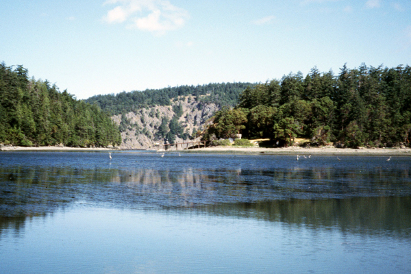
 Geographic Setting. This habitat reflects marine water areas (high tide line
to depth of 66 ft [20 m]) along shorelines not significantly affected by
freshwater inputs (i.e., excludes Bays and Estuaries). This includes all marine
shorelines of Puget Sound, Hood Canal, San Juan Islands, Strait of Georgia,
Strait of Juan de Fuca, and along the outer coastlines of Washington and Oregon.
In Washington, there are 3,100 miles (4,990 km) of this nearshore habitat 85
(H. D. Berry, Department of Natural Resources, Aquatic Resources Division,
Olympia, pers. comm.); in Oregon, there are 377 miles (607 km) of this nearshore
habitat (C. Barrett, Northwest Habitat Institute, Corvallis, Oregon, pers.
comm.). For mapping and classification purposes, this habitat does not extend
into, or overlap with, shallow or intertidal areas found within Bays and
Estuaries. Geographic Setting. This habitat reflects marine water areas (high tide line
to depth of 66 ft [20 m]) along shorelines not significantly affected by
freshwater inputs (i.e., excludes Bays and Estuaries). This includes all marine
shorelines of Puget Sound, Hood Canal, San Juan Islands, Strait of Georgia,
Strait of Juan de Fuca, and along the outer coastlines of Washington and Oregon.
In Washington, there are 3,100 miles (4,990 km) of this nearshore habitat 85
(H. D. Berry, Department of Natural Resources, Aquatic Resources Division,
Olympia, pers. comm.); in Oregon, there are 377 miles (607 km) of this nearshore
habitat (C. Barrett, Northwest Habitat Institute, Corvallis, Oregon, pers.
comm.). For mapping and classification purposes, this habitat does not extend
into, or overlap with, shallow or intertidal areas found within Bays and
Estuaries.
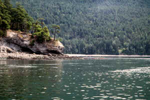
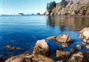
Physical Setting. The outer coastline of Washington and Oregon can be
characterized as a series of sandy beaches interspersed with rocky headlands.
This coastline is oriented in a north-south direction and is subjected to
long-fetch, high-energy waves. Nearshore areas within Puget Sound, Hood Canal,
and elsewhere landward from the Straight of Juan de Fuca, are more protected.
With the exception of the far-reaching Columbia River plume 194, the
effects of coastal streams are generally local and seasonal 170.
 Landscape Setting. This habitat is adjacent to the Marine Shelf, Inland
Marine Deeper Waters, Bays and Estuaries, and a number of terrestrial-based
habitats (e.g., Coastal Dunes and Beaches, Westside Lowland Conifer-Hardwood
Forest, and Urban). It occurs in a mosaic with Coastal Headlands and Islets. Landscape Setting. This habitat is adjacent to the Marine Shelf, Inland
Marine Deeper Waters, Bays and Estuaries, and a number of terrestrial-based
habitats (e.g., Coastal Dunes and Beaches, Westside Lowland Conifer-Hardwood
Forest, and Urban). It occurs in a mosaic with Coastal Headlands and Islets.
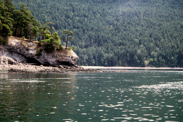
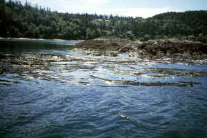
Structure. Fresh waters drain from lands surrounding these inland marine
waters to create estuarine environments nearshore 133 (see Bays and
Estuaries habitat). Nearshore subtidal habitats are diversified by degree of
wave and current action, availability of sunlight, and presence of vegetation.
Submerged unvegetated habitats cover a greater area than do vegetated nearshore
habitats, such as salt marshes and eelgrass beds. Various combinations of water
depth, character of substrates, and exposure to tidal action create a wide range
of benthic habitats. Sand, cobble, boulders, and hardpan are commonly found in
areas of moderate to strong currents, whereas silt and clay settle out in
protected inlets and bays 67, 145.
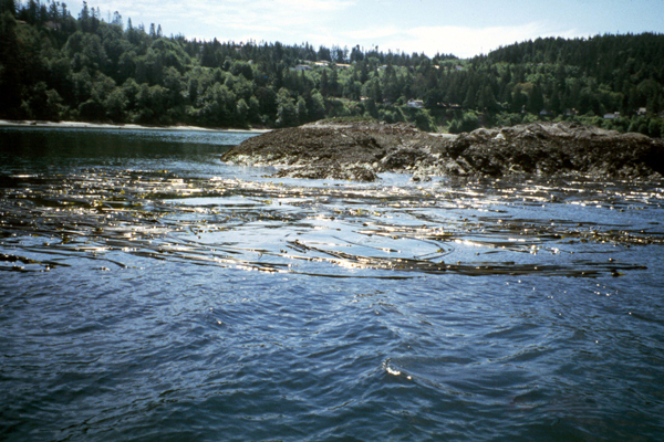
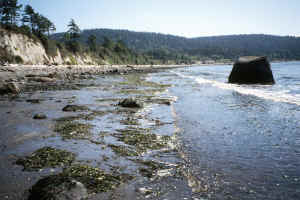 Composition. This habitat supports marine organisms capable of
withstanding short-term exposure to air. Bottom substrates in exposed areas are
generally rock or sand, but can include cobble or gravel. The subtidal photic
zone includes the region from mean low low water (MLLW or the 0 ft depth) to
about -50 ft (-15 m) where water is deep enough to prevent sufficient light
penetration to the marine floor for primary productivity of kelp and other
marine plants. The rocky-bottom intertidal habitats support kelps (Laminaria
spp., Lessoniopsis spp., Hedophyllum sessile), brown rockweed (Pelvetiopsis
limitata), red algae (Iridaea spp.), and surfgrass (Phyllospadix
scouleri) as well as an abundance and variety of sessile benthic
invertebrate. The larger kelps, such as Macrocystis integrifolia and Nereocystis
leutkeana, are found in the rocky-bottom subtidal areas. Because of constant
wave action, the sandy-bottom areas of the intertidal and subtidal zones support
few or no plants. The moderate to low energy intertidal and subtidal areas where
sand, mud, and gravel accumulate support eelgrass (Zostera marina
and Z. japonica), and the red alga (Gracilaria pacifica). Composition. This habitat supports marine organisms capable of
withstanding short-term exposure to air. Bottom substrates in exposed areas are
generally rock or sand, but can include cobble or gravel. The subtidal photic
zone includes the region from mean low low water (MLLW or the 0 ft depth) to
about -50 ft (-15 m) where water is deep enough to prevent sufficient light
penetration to the marine floor for primary productivity of kelp and other
marine plants. The rocky-bottom intertidal habitats support kelps (Laminaria
spp., Lessoniopsis spp., Hedophyllum sessile), brown rockweed (Pelvetiopsis
limitata), red algae (Iridaea spp.), and surfgrass (Phyllospadix
scouleri) as well as an abundance and variety of sessile benthic
invertebrate. The larger kelps, such as Macrocystis integrifolia and Nereocystis
leutkeana, are found in the rocky-bottom subtidal areas. Because of constant
wave action, the sandy-bottom areas of the intertidal and subtidal zones support
few or no plants. The moderate to low energy intertidal and subtidal areas where
sand, mud, and gravel accumulate support eelgrass (Zostera marina
and Z. japonica), and the red alga (Gracilaria pacifica).
Other Classifications and Key References. Dethier 68 provided
a detailed classification scheme for the estuary, intertidal, and shallow
subtidal areas of Washington. The Cowardin et al. 53 classification
scheme has several limitations with regards to adopting it for marine and
estuarine systems. Levings and Thom 143 described 9 categories of
nearshore habitat in Puget Sound and Georgia Basin.
 Natural Disturbance Regimes. This habitat is strongly influenced by tidal
rhythms, wave action, storm events, light penetration, and bottom substrate.
Because of these factors, this habitat is characterized by a high degree of
patchiness; this patchiness leads to differences in its faunal makeup and use.
Herbivory by marine invertebrates also causes significant disturbance in plant
communities, as evidenced by the direct control of kelp beds by urchin
populations. Natural Disturbance Regimes. This habitat is strongly influenced by tidal
rhythms, wave action, storm events, light penetration, and bottom substrate.
Because of these factors, this habitat is characterized by a high degree of
patchiness; this patchiness leads to differences in its faunal makeup and use.
Herbivory by marine invertebrates also causes significant disturbance in plant
communities, as evidenced by the direct control of kelp beds by urchin
populations.
Succession and Stand Dynamics. The primary natural processes that shape
the nearshore habitats include tides, erosion, accretion, and storm events. The
rocky surf zone of the outer coast of the Olympic Peninsula includes some of the
most complex and diverse shores in the United States 67. Here, high
wave energy provides space for habitation for species as materials are eroded
away, and by increasing the capacity of algae to acquire nutrients and use
sunlight. Examples of succession can be found on rocky intertidal shores where
wave energy periodically disturbs established communities, or in kelp forests
where herbivory or the scouring action of swift tidal currents removes
vegetation.
 Effects of Management and Anthropogenic Impacts. This habitat reflects
the interface between land and sea, and is the site of intense commercial and
navigational activities, such as seaports, marinas, ferry docks, and log booms.
A significant concern identified by Broadhurst 35 is the site-by-site
consideration of projects with no ability to account for and assess the
cumulative environmental effects of various development activities (from small
residential projects to large commercial and industrial development projects).
Without the ability to measure or understand cumulative effects, managers are
permitting individual activities that may result in dramatic resource losses
over time. Making high-quality nearshore vegetation and shoreline
characteristics inventory mapping available to land-use planners, natural
resource scientists, and the public will increase opportunities to protect this
habitat. Effects of Management and Anthropogenic Impacts. This habitat reflects
the interface between land and sea, and is the site of intense commercial and
navigational activities, such as seaports, marinas, ferry docks, and log booms.
A significant concern identified by Broadhurst 35 is the site-by-site
consideration of projects with no ability to account for and assess the
cumulative environmental effects of various development activities (from small
residential projects to large commercial and industrial development projects).
Without the ability to measure or understand cumulative effects, managers are
permitting individual activities that may result in dramatic resource losses
over time. Making high-quality nearshore vegetation and shoreline
characteristics inventory mapping available to land-use planners, natural
resource scientists, and the public will increase opportunities to protect this
habitat.
Status and Trends. Shoreline modification such as bulkheading, filling,
and dredging can lead to direct habitat loss. Indirectly, it can lead to changes
in the sediment and wave energy on a beach and in adjacent subtidal areas. One
third of Puget Sound’s shorelines, approximately 800 miles (1,287 km), has
been modified 180, 190, 191. The Central Puget Sound region, with
high human population levels, shows the highest level of modification overall
(52%) 180. In Washington there are 26 species of kelp, more than any
other area worldwide 77. Data on floating kelp along the Strait of
Juan de Fuca suggest that while kelp areas are dynamic, the overall extent of
kelp has remained stable during 1993-1997 180.
[ Top ]
[ Literature Citations ]
[ Wildlife-Habitat Types - Table 1 ]
|