FY 2002 Columbia Plateau proposal 199401807
Contents
Section 1. General administrative information
Section 2. Past accomplishments
Section 3. Relationships to other projects
Section 4. Budgets for planning/design phase
Section 5. Budgets for construction/implementation phase
Section 6. Budgets for operations/maintenance phase
Section 7. Budgets for monitoring/evaluation phase
Section 8. Budget summary
Reviews and Recommendations
Additional documents
| Title | Type |
|---|---|
| 199401807 Narrative | Narrative |
| 199401807 Sponsor Response to the ISRP | Response |
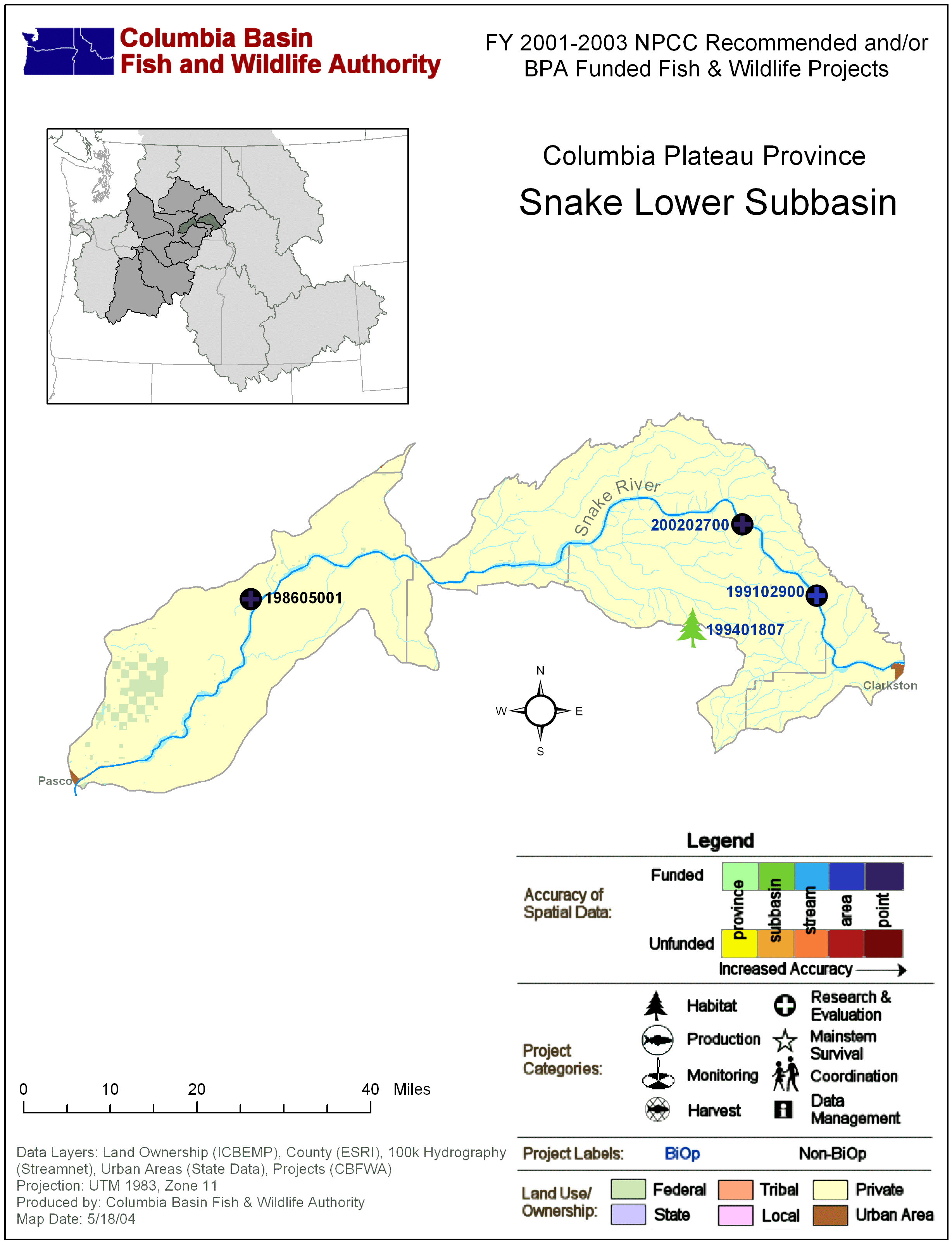
| Columbia Plateau: Snake Lower Subbasin Map with BPA Fish & Wildlife Projects | Subbasin Map |
| Columbia Plateau: Snake Lower Subbasin Map with BPA Fish & Wildlife Projects | Subbasin Map |
Section 1. Administrative
| Proposal title | Garfield County Sediment Reduction and Riparian Improvement Program |
| Proposal ID | 199401807 |
| Organization | Pomeroy Conservation District (PCD) |
| Proposal contact person or principal investigator | |
| Name | Duane Bartels |
| Mailing address | P.O. Box 468 Pomeroy, WA 99347 |
| Phone / email | 5098431998 / duanebar@pomeroy-wa.com |
| Manager authorizing this project | Duane Bartels |
| Review cycle | Columbia Plateau |
| Province / Subbasin | Columbia Plateau / Mainstem Snake |
| Short description | Coordinate, implement, and monitor conservation practices for the reduction of sediment from the uplands of Garfield County and enhance habitat in the riparian zones of the streams to improve water quality for Steelhead and Chinook Salmon. |
| Target species | Steelhead, Chinook Salmon |
Project location
| Latitude | Longitude | Description |
|---|---|---|
| 46.486 | -117.5502 | Projects located throughout Garfield County |
Reasonable and Prudent Alternatives (RPAs)
Sponsor-reported:
| RPA |
|---|
Relevant RPAs based on NMFS/BPA review:
| Reviewing agency | Action # | BiOp Agency | Description |
|---|---|---|---|
| NMFS | Action 153 | NMFS | BPA shall, working with agricultural incentive programs such as the Conservation Reserve Enhancement Program, negotiate and fund long-term protection for 100 miles of riparian buffers per year in accordance with criteria BPA and NMFS will develop by June 1, 2001. |
Section 2. Past accomplishments
| Year | Accomplishment |
|---|---|
| 2000 | 4,685 acres of No-till seeding was cost shared to reduce erosion on cropland and further educate farmers to this practice. |
| 4,571 acres of Direct seeding was cost shared to reduce erosion on cropland and further educate farmers to this practice. | |
| 27,711 cubic yards of material was moved in the contruction of new sediment basins throughout the county. | |
| 4,878 cubic yards of material was removed from existing sediment basins and placed back on the land. | |
| 9,000 feet of riparian fencing was constructed to remove or manage livestock within the riparian areas of county streams. | |
| 120 acres of grass in rotation was planted on highly erodible ground to reduce erosion and improve water infiltration. | |
| 4,308 feet of grassed waterway was constructed to protect area from gully erosion. | |
| 79 acres of pasture was planted on highly erodible ground that is only suitable for this use. | |
| 4,375 feet of level and gradient terraces were contructed or rebuilt to help collect runoff from fields. | |
| Over 12,000 trees and shrubs were planted at various sites within the Pataha watershed. | |
| 1999 | 2,640 acres of deep fall subsoiling was cost shared to breakup impermeable soil layers and increase water infiltration. |
| 5,477 acres of No-till seeding was cost shared to reduce erosion on cropland and further educate farmers to this practice. | |
| 4,984 acres of two pass seeding was cost shared to reduce erosion on cropland and further educate farmers to this practice. | |
| 34,333cubic yards of material was moved in the contruction of new sediment basins throughout the county. | |
| 1,080 feet of riparian fencing was constructed to remove or manage livestock within the riparian areas of county streams. | |
| 128 acres of grass in rotation was planted on highly erodible ground to reduce erosion and improve water infiltration. | |
| 9,445 feet of grassed waterway was constructed to protect area from gully erosion. | |
| 94 acres of pasture was planted on highly erodible ground that is only suitable for this use. | |
| 1 spring development was cost shared to better distribute livestock. | |
| 571 acres of stripcropping was cost shared to reduce erosion on cropland. | |
| 42,702 feet of level and gradient terraces were contructed or rebuilt to help collect runoff from fields. | |
| 1.6 acres of upland habitat was developed for wildlife enhancement | |
| Over 10,000 trees and shrubs were again planted at various sites within the Pataha Creek watershed. | |
| 1998 | 5,268 acres of deep fall subsoiling was cost shared to breakup impermeable soil layers and increase water infiltration. |
| 2,925 acres of No-till seeding was cost shared to reduce erosion on cropland and further educate farmers to this practice. | |
| 2,235 acres of two pass seeding was cost shared to reduce erosion on cropland and further educate farmers to this practice. | |
| 4.2 acres of highly erodible ground was seeding to grass under the critical area seeding NRCS guidelines. | |
| 49,176 cubic yards of material was moved in the contruction of new sediment basins throughout the county. | |
| 940 cubic yards of material was removed from existing sediment basins and placed back on the land. | |
| 221 acres of highly erodible ground was put under a divided slope system using NRCS guidelines. | |
| 9,080 feet of riparian fencing was constructed to remove or manage livestock within the riparian areas of county streams. | |
| 51 acres of upland and riparian buffer strip was established for wildlife habitat and sediment delivery reduction. | |
| 104 acres of grass in rotation was planted on highly erodible ground to eliminate the erosion problem. | |
| 18,463 feet of grassed waterway was constructed to protect area from gully erosion. | |
| 56 acres of pasture was planted on highly erodible ground that is only suitable for this use. | |
| 24,716 feet of pipeline was cost shared to better distribute livestock away from Pataha Creek. | |
| 706 acres of stripcropping was cost shared to reduce erosion on cropland. | |
| 70,224 feet of level and gradient terraces were contructed or rebuilt to help collect runoff from fields. | |
| 15,600 trees and shrubs were planted at various sites with the Pataha Creek watershed. | |
| 1997 | 4,131 acres of deep fall subsoiling was cost shared to breakup impermeable soil layers and increase water infiltration. |
| 2,447 acres of No-till seeding was cost shared to reduce erosion on cropland and further educate farmers to this practice. | |
| 15.4 acres of highly erodible ground was seeding to grass under the critical area seeding NRCS guidelines. | |
| 45,447 cubic yards of material was moved in the contruction of new sediment basins throughout the county. | |
| 2,754 cubic yards of material was removed from existing sediment basins and placed back on the land. | |
| 2,092 feet of riparian fencing was constructed to remove or manage livestock within the riparian areas of county streams. | |
| 29 acres of upland and riparian buffer strip was established for wildlife habitat and sediment delivery reduction. | |
| 400 feet of Pataha Creek was improved using rock vanes to reduce erosion of the banks and improve habitat. | |
| 88 acres of grass in rotation was planted on highly erodible ground to eliminate the erosion problem. | |
| 14,499 feet of grassed waterway was constructed to protect area from gully erosion. | |
| 6,949 feet of pipeline was cost shared to better distribute livestock away from Pataha Creek. | |
| 1 spring development was cost shared to better distribute livestock. | |
| 1,395 acres of stripcropping was cost shared to reduce erosion on cropland. | |
| 154,691 feet of level and gradient terraces were contructed or rebuilt to help collect runoff from fields. | |
| 5,500 trees and shrubs were planted at various sites with the Pataha Creek watershed. | |
| 3 offsite livestock watering facilities were developed to remove livestock from the riparian area and reduce their impact on the streams. | |
| 1996 | 1,197 ft. of channel was revegetated with plantings to use as demonstration sites. |
| 1,109 acres of deep fall subsoiling was cost shared to breakup impermeable soil layers and increase water infiltration. | |
| 3,312 acres of No-till seeding was cost shared to reduce erosion on cropland and further educate farmers to this practice. | |
| 2.4 acres of highly erodible ground was seeding to grass under the critical area seeding NRCS guidelines. | |
| 15,849 cubic yards of material was moved in the contruction of new sediment basins throughout the county. | |
| 4,428 cubic yards of material was removed from existing sediment basins and placed back on the land. | |
| 40 acres of highly erodible ground was put under a divided slope system using NRCS guidelines. | |
| 4 acres of upland and riparian buffer strip was established for wildlife habitat and sediment delivery reduction. | |
| 600 feet of Pataha Creek was improved using rock vanes to reduce erosion of the banks and improve habitat. | |
| 77 acres of grass in rotation was planted on highly erodible ground to eliminate the erosion problem. | |
| 40,795 feet of grassed waterway was constructed to protect area from gully erosion. | |
| 39 acres of stripcropping was cost shared to reduce erosion on cropland. | |
| 213,023 feet of level and gradient terraces were contructed or rebuilt to help collect runoff from fields. | |
| 1,780 trees and shrubs were planted at various sites with the Pataha Creek watershed. | |
| 1 offsite livestock watering facilities were developed to remove livestock from the riparian area and reduce their impact on the streams. | |
| 1995 | 1,780 feet of riparian fencing was constructed to remove or manage livestock within the riparian areas of county streams. |
| 1994 | Worked with NRCS personnel in gathering data on Pataha Creek and putting together a draft plan for review of the landowner/steering and technical advisory committee |
| 1993 | Began process of setting up landowner and technical advisory committee members to oversee the preliminary writing and implementation of the Pataha Creek Model Watershed Plan. |
| Became one of three model watersheds in the state to restore and enhance habitat for the endangered Snake River Chinook Salmon. |
Section 3. Relationships to other projects
| Project ID | Title | Description |
|---|---|---|
| Upland conservation practices | All upland conservation practices implemented over the last 5 years a connected in the sense that they are reducing the amount of sedimentation reaching our streams in Garfield County. | |
| Riparian restoration projects | All riparian projects are implemented to restore habitat along the streams to improve fish and wildlife habitat. | |
| Demonstration projects | These projects were used to inform and educate landowners and operators what the intention of the cost share programs are in reference to salmon recovery. | |
| Monitoring projects | These programs are used in conjunction with all implementation projects, both upland and riparian, to show the effects of the practices on water quality and habitat. |
Section 4. Budget for Planning and Design phase
Task-based budget
| Objective | Task | Duration in FYs | Estimated 2002 cost | Subcontractor |
|---|---|---|---|---|
| 1. Coordinate all planning and administration of the conservation practices within district. | a. continue administration and communications of county wide conservation and restoration activities. | 5 | $29,000 | |
| b. Work with landowners and district board to priotitize project implementation. | 5 | $3,000 | ||
| c. Provide information on district's project implementation, costs, and project effectiveness | 5 | $2,600 | ||
| 2. Obtain and utilize limiting factors data . | a. Obtain current data from limiting factors analysis being conducted by Conservation Commission. | 1 | $300 | |
| b. analyze data to locate problem areas of county. | 1 | $1,500 | ||
| c. Use data to prioritize upland and riparian projects for all streams in county | 1 | $1,000 | ||
| 3. Coordinate CREP and Continuous CRP signup's. | a. work with NRCS and FSA on CREP and CRP signups in county. | 5 | $1,000 | |
| 5 | $0 |
Outyear objectives-based budget
| Objective | Starting FY | Ending FY | Estimated cost |
|---|---|---|---|
| 1. Coordinate all planning and implementation of the conservation practices within district.. | 2003 | 2006 | $155,000 |
| 2. Obtain and utilize limiting factors data | 2000 | 2000 | $0 |
| 3. Coordinate CREP and Continuous CRP signup's. | 2003 | 2006 | $4,000 |
Outyear budgets for Planning and Design phase
| FY 2003 | FY 2004 | FY 2005 | FY 2006 |
|---|---|---|---|
| $39,000 | $39,500 | $40,000 | $40,500 |
Section 5. Budget for Construction and Implementation phase
Task-based budget
| Objective | Task | Duration in FYs | Estimated 2002 cost | Subcontractor |
|---|---|---|---|---|
| 1.Reduce sediment deposition into streams by substantially reducing streambank, rangeland and cropland erosion. | a. Continue upland cost-share program with a focus on no-till, direct seeding, and changing crop rotations to annual cropping in high priority sub-watersheds. | 5 | $132,000 | |
| (Lower Snake Co-managers Obj.)Increase spawning and incubation success. | b. Riparian fencing, tree and shrub planting to stabilize streambanks and recruit LWD in high priority areas. | 5 | $7,500 | Yes |
| 2. Maintain low water temperatures. | a. Continue yearly tree planting program along Pataha Creek and expand this program into high priority areas of other watersheds in the county. | 5 | $7,500 | Yes |
| b. Riparian fencing to manage plantings along stream banks and in riparian zone. | 5 | $7,500 | Yes | |
| 3. Improve water quality by removing livestock from riparian area | a. additional funding needed outside CREP program | 5 | $7,500 |
Outyear objectives-based budget
| Objective | Starting FY | Ending FY | Estimated cost |
|---|---|---|---|
| 1. Reduce sediment deposition | 2003 | 2006 | $400,000 |
| 2. Maintain low water temperatures | 2003 | 2006 | $60,000 |
| 3. Improve water quality | 2003 | 2006 | $30,000 |
Outyear budgets for Construction and Implementation phase
| FY 2003 | FY 2004 | FY 2005 | FY 2006 |
|---|---|---|---|
| $150,000 | $140,000 | $120,000 | $80,000 |
Section 6. Budget for Operations and Maintenance phase
Task-based budget
| Objective | Task | Duration in FYs | Estimated 2002 cost | Subcontractor |
|---|
Outyear objectives-based budget
| Objective | Starting FY | Ending FY | Estimated cost |
|---|
Outyear budgets for Operations and Maintenance phase
Section 7. Budget for Monitoring and Evaluation phase
Task-based budget
| Objective | Task | Duration in FYs | Estimated 2002 cost | Subcontractor |
|---|---|---|---|---|
| 1. Assess and monitor efficiency and effectiveness of practices being implemented | a. Coordinate data colllection from producers on cultural practice installation (no-till, direct seed) to evaluate overall cost and effectiveness of projects. | 5 | $6,700 | |
| b. Continue for one more year, the runoff plot study with WSU on no-till comparison to conventional tillage practices. | 1 | $900 | ||
| c. Complete and make available reports on the results of assessment and monitoring | 1 | $1,000 | ||
| d. Maintain existing ISCO's and analyse samples for total suspended solids. | 5 | $2,000 | ||
| 2. Plan and coordinate assessments and limiting factors. | a. Work with WDFW and Conservation Commission on conducting inventories and limiting factors analysis in Pataha, Alpowa, Deadman, and Meadow Creek watersheds. | 1 | $1,000 | |
| 3. Begin water quality testing in 2004 on all streams with WSU/CEE | a. test water quality to monitor success or failure of last 3 years of implementation | $0 | Yes |
Outyear objectives-based budget
| Objective | Starting FY | Ending FY | Estimated cost |
|---|---|---|---|
| 1. Assess and monitor effeciency and effectiveness of practices | 2003 | 2006 | $42,000 |
| 2. Plan and coordinate assessments and limiting factors | 2004 | 2006 | $3,000 |
| 3. Water quality testing beginning in 2004 | 2004 | 2006 | $120,000 |
Outyear budgets for Monitoring and Evaluation phase
| FY 2003 | FY 2004 | FY 2005 | FY 2006 |
|---|---|---|---|
| $10,500 | $51,500 | $51,500 | $51,500 |
Section 8. Estimated budget summary
Itemized budget
| Item | Note | FY 2002 cost |
|---|---|---|
| Personnel | FTE: .5 | $33,979 |
| Fringe | Social Security, Medicare, Medical Insurance, other insurance | $11,699 |
| Supplies | office supplies, newsletters, communication | $2,546 |
| Travel | Workshops, conventions, annual meeting | $1,776 |
| Other | Cost share program for upland and riparian projects | $162,000 |
| $212,000 | ||
Total estimated budget
| Total FY 2002 cost | $212,000 |
| Amount anticipated from previously committed BPA funds | $25,000 |
| Total FY 2002 budget request | $187,000 |
| FY 2002 forecast from 2001 | $134,500 |
| % change from forecast | 39.0% |
Reason for change in estimated budget
Under the new Provincial Subbasin process, the remainder of Garfield County is being included in this budget for funding. This has increased the amount of funds being requested
Reason for change in scope
Garfield County is being covered under this proposal, not just the Pataha Creek Watershed. Alpowa, Deadman, and Meadow Creeks are also being addressed under this proposal for salmon habitat improvement.
Cost sharing
| Organization | Item or service provided | Amount | Cash or in-kind |
|---|---|---|---|
| Wash. St. Conservation Commission | Upland BMP Cost Share Program | $50,000 | cash |
| USDA NRCS | technical, engineering, evaluation | $35,000 | in-kind |
| USDA ARS | 3 year runoff plot comparison | $140,000 | in-kind |
| WDFW | redd survey, assessment on Deadman and Meadow Creeks | $10,000 | in-kind |
| WDFW Lead Entity Funding | Administrative Funding for habitat implementation | $25,000 | cash |
| Landowners | materials, labor, equipment | $880,000 | in-kind |
Reviews and recommendations
This information was not provided on the original proposals, but was generated during the review process.
Fundable only if response is adequate
Jun 15, 2001
Comment:
Fundable if adequate responses are given to ISRP concerns. This is an ongoing project in part. It appears to have been previously directed to conditions in the Pataha Basin, but is now being expanded to entire Garfield County. Project personnel acknowledged (page 12) that management of riparian areas and uplands are key elements in determining the quality of streams for native fishes. Apparently they came to this conclusion after failure of efforts in site-specific engineered projects. It would be useful for these investigators to document the evolution of their thinking so that others could benefit from their experiences.
The work has been ongoing since 1993, presumably including monitoring of project successes and failures. No data were presented to facilitate a review of progress in increasing fishery or habitat benefits. Data were discussed concerning the amount of soil erosion prevented by no-till farming. Large amounts of topsoil seem to be retained by this method showing it to be an effective soil conservation measure, but that result does not translate directly to improved fishery benefits. The proposal needs to include fishery/habitat benefit information, or there is no basis for continuing the work as an element of a fish restoration program. This far into the program, information should be coming available to begin forming a relation between sediment in streams and percent of acres in no-till, for example.
What is the evidence to convince skeptical reviewers, ranchers, and rate-payers that increasing investment in this project is helping to increase fish abundance, or that it has any realistic chance of significantly improving conditions for fish in the foreseeable future?
The sub-basin summary includes monitoring of water temperature, stream discharge, and data to be obtained by WDFW concerning habitat measures and fish utilization. The proposal would benefit if any of these data can be used to show benefits from the project.
The Sub-basin summary also includes the following statements. "The Pataha Creek Water Quality Monitoring Project (Project), a collaborative effort between the PCD and WSU, was initiated in September 1998. The Project aims to assess the success of agricultural management practices for Pataha Creek. Project objectives include 1) providing evidence of the effectiveness of PCD efforts to address key water quality parameters, and (2) providing baseline data for assessing the creeks' water quality status. The PCD is also collecting data from 2 ISCO samplers that are located in upper Pataha Creek and the lower Tucannon River. The PCD has operated these samplers for three years and samples twice daily for TSS. The samples have shown that the sediment delivered into Pataha Creek originates from runoff events caused by thunderstorms and/or rain on frozen ground conditions. The implementation of upland conservation practices along with riparian restoration projects will eventually reduce this problem." Any data available from this monitoring should also be presented in the proposal to help show whether the program is showing benefits or alternative approaches are needed.
The response should further describe the project's selection of monitoring approach (tier), for establishing the project's biologically measurable results, and the justification of this selection (see ISRP's general comments on monitoring).
Comment:
This project benefits an ESU by reducing the amount of soil erosion on cropland, rangeland, and riparian areas through conservation efforts. Project may address RPA 153. This project needs to be implemented consistent with limiting factors and problem locations identified in subbasin summaries and eventually subbasin planning to insure fisheries benefits to target species. There needs to be oversight by the COTR to insure that actions taken will benefit fish and wildlife.Comment:
Not fundable as stands. Fundable only if they include better justification of the biological benefits of converting farmland production to no-till and a rigorous economic analysis.This is an ongoing project (since 1993) that was first directed to conditions in the Pataha Basin, but is now being expanded to entire Garfield County. Sponsors acknowledged that management of riparian areas and uplands are key elements in determining the quality of streams for native fishes, a conclusion apparently reached after site-specific engineered projects failed. The performance of these bio-engineered projects should be documented so that others could benefit from their experience, especially since this approach is being used as a guide for projects elsewhere.
The materials provided failed to address the key questions raised by reviewers. No data were presented to review progress in increasing fishery or habitat benefits, but a review and copy of materials in agency reports was used to justify the approach. The approach appears valid in reducing sediment, but the material provided indicated sediment is delivered from catastrophic storm events, and we asked for evidence of improvements in fish abundance and survival.
The proponents note that the market will dictate whether there is general acceptance of a no-till approach. However, they then proceed to make a strong case for continuing the no-till project. Reviewers are left with the uncertainty that even with full cooperation in no-till farming, sediment, habitat, and economic issues will remain. Like project 25050, this is an experiment in the economics of alternate farming practices. The larger question that both these projects should be helping to answer is "what is the most cost-effective way to reduce sedimentation in streams?" No-till, riparian buffer strips, and CRP set-asides should all be analyzed to address this question.
The project needs involvement of an experienced analyst to assess effectiveness of the work to date. The primary need is to assess whether or not the program is causing significant reduction of sediment input to streams and to important downstream spawning areas. If an improving trend can be described, what is the distribution and abundance of acres needed to be under no-till to attain substrate goals in spawning areas? No-till seems to be an effective means to reduce erosion, and that is good, but the goal here is to improve conditions for fish.
No evidence is provided to convince skeptical reviewers, ranchers, and rate-payers that increasing investment in this project is helping to increase fish abundance, or that it has any realistic chance of significantly improving conditions for fish in the foreseeable future.
Comment:
Statement of Potential Biological Benefit to ESUContinuing aid to the farmers and ranchers of Garfield County in their continuing effort to reduce the amount of soil erosion on cropland, rangeland, and riparian areas through conservation practices.
Comments
Proposal would be stronger if monitoring data was able to show reduced erosion as result of 7 years of implementation.
Already ESA Req? no
Biop? yes
BPA Funding Recommendation
Rank A (if implemented as described)
Oct 16, 2001
Comment:
This project proposes to expand beyond its work in the Pataha watershed into three other small watersheds. These streams all contain wild populations of listed steelhead. There is currently very little use of the upper mainstem Pataha Creek by steelhead, and these three watersheds combined appear to have greater potential for steelhead enhancement than the upper Pataha Creek. The primary goal for the mainstem Pataha Creek watershed is to improve water quality for the lower Tucannon (reduced sediment and temperature), not on steelhead habitat enhancement.Recommend funding to maintain the base coordination and planning function of watershed coordination, Section 4, Objective1. Objective 2 should focus on Alpowa Creek. This assessment should be focused in coordination with the Conservation Commission and the Washington Department of Fish and Wildlife. Limited effort may be placed in Deadman and Meadow Creeks and in the main Pataha in coordination with the Conservation Commission in preparation for subbasin planning. Objective 3 should focus in Alpowa Creek, but not to the exclusion of CREP coordination in the other watersheds. Fund Section 5, Objective 1 only in Alpowa Creek after an initial assessment shows a direct link between cropland sediment runoff and steelhead productivity. This should only be funded if an integrated M&E program is established in cooperation with the Washington Department of Fish and Wildlife, Washington State University, and appropriate USDA research personnel. Objectives 2 and 3 should only be funded in high priority areas in Pataha Creek as it affects the lower Tucannon and in Alpowa Creek. Fund Section 7, with M&E focused on Alpowa Creek and possibly on existing M&E sites in Pataha Creek, but only after a review of the potential for ongoing M&E to be related to changes in salmonid productivity and the effects of temperature and sediment in the lower Tucannon.
Comment:
ISRP "Not fundable as stands" recommendation for the ongoing Garfield County Sediment Reduction and Riparian Improvement Program; ongoing project 199401807 This project intends to coordinate, implement, and monitor conservation practices for the reduction of sediment from the uplands of Garfield County and enhances habitat in the riparian zones of the streams to improve water quality for steelhead and chinook salmon. The ISRP recommendation was based on the lack of justification of the biological benefits from the project. In addition responses failed to address the issues raised by the reviewers. BPA recommends funding to maintain the base coordination and planning function of the project, and expanding the focus of the project from Pataha watershed to three other small watersheds.
Staff recommendation: The staff concludes that the ISRP's comments highlight critical concerns about the continuation of this project. The staff recommends continued funding of the base program and selected passive restoration strategies (i.e. planting, riparian buffers) addressed in Section 4, objectives 1, 2 and 3; Section 5, objective 1, task b, objective 2 and 3, and Section 7. The staff recommends that the budget not include funding for Section 5 (objective 1a), no-till, direct seeding and changing crop rotation until better justification of the biological benefits is presented. In addition funding needs to address issues only in the Pataha Basin. Bonneville funding for this effort needs to be justified in the Council's subbasin planning process. Budgets for FY 2003 and 2004 need to be refined to reflect the recommended approach in the development of the FY 2002 Budget and SOW. Maintaining the coordination function, as was provided for similar projects in the Kootenai and Flathead subbasins, preserves staff support for subbasin planning in the Tucannon. The contract for this project should be written to support subbasin planning.
Budget effect on base program (Project 199401807):
| FY 2002 | FY 2003 | FY 2004 |
|---|---|---|
| Increase $80,000 | Increase $80,000 | Increase $80,000 |
Comment:
Comment:
Comment:
The FY 2004 is a barebones budget to keep the program alive in the county during this period of budget reductions and before the subbasin plans are written. We only have $12,000 of funding available for additional project implementation in the Pataha Watershed. The $80,000 requested for FY 2005 is to again implement projects to improve fish and wildlife habitat. The subbasin plans for the Lower Snake and Tucannon will be completed by then and the implementation process can continue.NW Power and Conservation Council's FY 2006 Project Funding Review
expense
May 2005
| FY05 NPCC start of year: | FY06 NPCC staff preliminary: | FY06 NPCC July draft start of year: |
| $80,000 | $80,000 | $80,000 |
Sponsor comments: See comment at Council's website